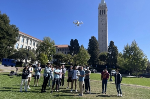
Last Monday, students from CE 170A, a "Smart Infrastructure Sensing and Modeling" class, met on campus to see how to obtain 3D data. They planned flights using UAVs equipped with cameras and Light Detection and Ranging (LiDAR) and also ran LiDar scans. CEE Professors Dimitrios Zekkos and Robert Kayen led the sessions, who, along with Professor Kenichi Soga, serve as co-instructors of the course. Ph.D. students Jaewson Saw, who serve as GSI's, and Drew Gomberg and Parker Blunts helped organize the session.
This test was just one of the modules of CE 170 that also includes wireless sensing and fiber optics measurement, subsurface mapping, wildfire emergency response, and evacuation modeling.
An overview of the course can be seen in this video.